 (0)
(0)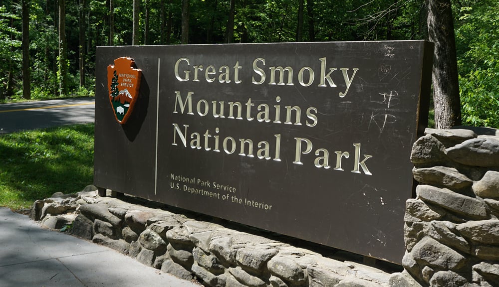
Great Smoky Mountains National Park offers 800+ miles of trails, ranging from flat riverside walks to lung-burning summit climbs. These 15 trails represent the best hiking across the park, organized by difficulty so you can find the right challenge.
Looking for trails closest to downtown Gatlinburg? See our detailed guide to the 10 best Gatlinburg hiking trails.
Quick Trail Guide: Key Details Summary
Use this quick comparison table to find the perfect trail based on difficulty, distance, drive time, and highlights.
| # | Trail Name | Difficulty | Distance (Round-trip) | Elevation Gain | Drive from Gatlinburg | Key Features | Notes |
|---|---|---|---|---|---|---|---|
| 1 | Sugarlands Valley Nature Trail | Easy | 0.5-mi loop | 95 ft | 5-10 min | Paved; wheelchair/stroller friendly | Near visitor center |
| 2 | Cataract Falls Trail | Easy | 1.1 mi | 150 ft | 5-10 min | Waterfall; kid friendly | Quick waterfall hike |
| 3 | Gatlinburg Trail | Easy | 3.8 mi | 235 ft | 0-5 min | Dog & bike friendly; riverside | Only dog-friendly trail near town |
| 4 | Spruce-Fir Nature Trail | Easy | 0.4-mi loop | 26 ft | 35-45 min | High-elevation forest; planked | Kuwohi Rd closed Dec – Mar |
| 5 | Porters Creek Trail | Easy – Moderate | 4 mi | 400 ft | 30-35 min | Wildflowers; historic sites; waterfall | Spring wildflower hotspot |
| 6 | Laurel Falls Trail | Easy – Moderate | 2.6 mi | 314 ft | 10-20 min | 80-ft waterfall; paved | CLOSED through mid-2026 |
| 7 | Deep Creek Waterfall Loop | Moderate | 2.4-mi loop | 413 ft | 1.5 hr (NC side) | 3 waterfalls; family friendly | Less crowded; tubing nearby |
| 8 | Grotto Falls (Trillium Gap) | Moderate | 2.6 mi | 585 ft | 25-30 min | Walk-behind waterfall | Roaring Fork Rd closed Dec – Mar |
| 9 | Baskins Creek Falls Trail | Moderate | 3 mi | 620 ft | 15-20 min | Hidden 40-ft waterfall | Less crowded; limited parking |
| 10 | Abrams Falls Trail | Moderate | 5 mi | 639 ft | 1 hr | Voluminous waterfall; wildlife | Cades Cove (traffic delays possible) |
| 11 | Alum Cave Trail to Bluffs | Moderate | 4.4 mi | 1,125 ft | 20-25 min | Arch Rock; panoramic views | Continued route to Mt. LeConte |
| 12 | Rainbow Falls Trail | Moderate – Strenuous | 5.4 mi | 1,500 ft | 10-15 min | Tallest single-drop waterfall | Rocky; afternoon rainbow effect |
| 13 | Chimney Tops Trail | Strenuous | 3.8 mi | 1,400 ft | 15-25 min | Panoramic views | Final summit section closed |
| 14 | Alum Cave Trail to Mt. LeConte | Strenuous | 11.2 mi | 3,077 ft | 20-25 min | Third-highest peak | All-day hike; early start needed |
| 15 | Charlies Bunion (Appalachian Trail) | Strenuous | 8 mi | 1,886 ft | 35-45 min | Panoramic views; rocky outcrop | Less crowded |
3. Gatlinburg Trail
Easy5. Porters Creek Trail
Easy – Moderate6. Laurel Falls Trail
Easy – Moderate7. Deep Creek Waterfall Loop
Moderate8. Grotto Falls (Trillium Gap)
Moderate9. Baskins Creek Falls Trail
Moderate10. Abrams Falls Trail
Moderate11. Alum Cave Trail to Bluffs
Moderate12. Rainbow Falls Trail
Moderate – Strenuous13. Chimney Tops Trail
Strenuous14. Alum Cave Trail to Mt. LeConte
Strenuous15. Charlies Bunion (Appalachian Trail)
StrenuousQuick Picks by Feature
- Waterfall hikes: Rainbow Falls, Grotto Falls, or Deep Creek Loop
- Panoramic views: Charlies Bunion, Alum Cave / Mt. LeConte, or Chimney Tops
- Dog friendly: Gatlinburg Trail (only pet-friendly option near town!)
- Best for kids: Sugarlands Valley, Deep Creek Loop, or Cataract Falls
- Less crowded: Porters Creek, Baskins Creek Falls, or Abrams Falls
- Most challenging: Alum Cave to Mt. LeConte
Trail Guide Overview
- Easy Trails
- Moderate Trails
- Strenuous Trails
- Top Scenic Drive & Observation Tower
- Smoky Mountain Trails FAQ
- Nearby Cabins
Easy Trails (6 Hikes)

1. Sugarlands Valley Nature Trail
Distance: 0.5-mile loop
Elevation Gain: 95 feet
Difficulty: Easy
Drive from Downtown: 5-10 minutes
Allow: 20-30 minutes
Trail Surface: 100% paved; wheelchair accessible
Parking: Shared with visitor center, rarely full
Why Visit: Stroller friendly; quick stop
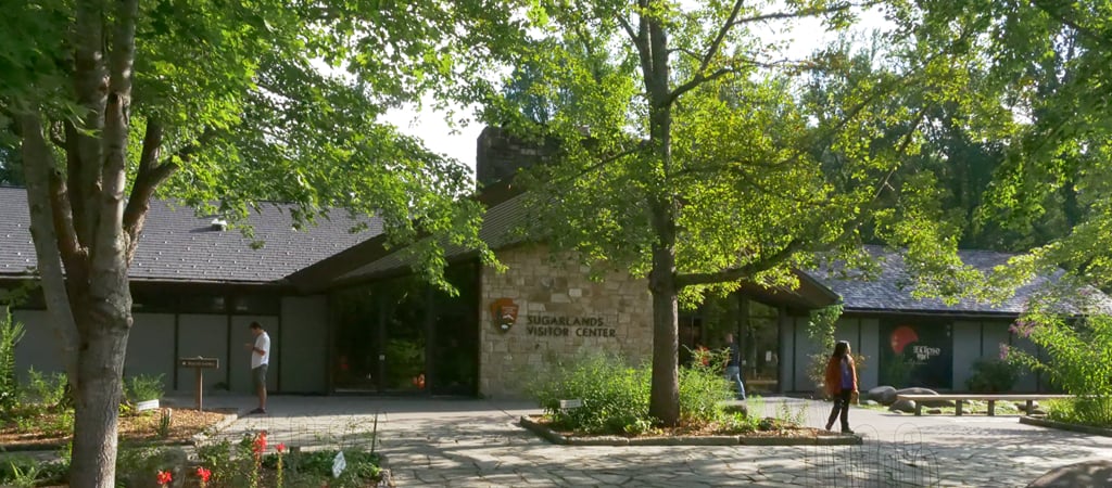
A short, fully paved loop right beside Sugarlands Visitor Center, the trail winds through a quiet forest and includes easy-to-read signs that explain the plants, wildlife, and history of the Smokies. You can also swing into the visitor center afterward to check out free exhibits.
The path is smooth and flat, so wheelchairs and strollers handle it without any trouble. In fact, this is the only ADA-compliant trail in the park! Great for grandparents, toddlers, or anyone who wants a quick, low-effort way to enjoy the Smokies, it’s a top pick for many.
For more family-friendly trails in the Smokies, check out our list of stroller-friendly hikes.
2. Cataract Falls Trail
Distance: 1.1 miles round-trip
Elevation Gain: 150 feet
Difficulty: Easy
Drive from Downtown: 5-10 minutes
Allow: 30-45 minutes
Trail Surface: Partially paved; wheelchair accessible (GRIT Freedom Chairs are first-come, first-served.)
Parking: Visitor center lot, rarely full
Why Visit: Shortest waterfall hike; kid friendly
A super quick and easy walk to one of the closest waterfalls in Gatlinburg, the paved path winds along Fighting Creek and leads you to a gentle 40-foot cascade that really pops after a rainy day. It’s not the biggest showstopper, but it’s perfect when you want something simple, scenic, and kid friendly.
If you want a little more time outside, you can link this with the Sugarlands Valley Nature Trail and make it a relaxed hour right from the visitor center.
3. Gatlinburg Trail
Important Note: Black bears are often spotted here, so give them at least 50 yards if you see one.
Distance: 3.8 miles round-trip
Elevation Gain: 235 feet
Difficulty: Easy
Drive from Downtown: 0-5 minutes
Allow: 1.5-2 hours
Trail Surface: 100% paved; pet friendly; wheelchair accessible
Parking: Large visitor center lot, rarely full
Why Visit: Dogs allowed; biking allowed; riverside; kid friendly

Gatlinburg Trail Trailhead, Great Smoky Mountains — photo by Scott Basford (Blinutne), via Wikimedia Commons
The only trail in the national park that welcomes both dogs and bikes, this flat, shaded path follows the West Prong of the Little Pigeon River from downtown Gatlinburg to Sugarlands Visitor Center.
You’ll see old stone walls, homestead remnants, and a few easy spots where kids can hop down and splash in the creek. It’s an easy out-and-back, and you can start from either end.
See our detailed Gatlinburg hiking trails guide for more trails near downtown.
4. Spruce-Fir Nature Trail
Important Note: Kuwohi Road closes from December through March, making this trail inaccessible in winter.
Distance: 0.4-mile loop
Elevation Gain: 26 feet (minimal, mostly flat)
Difficulty: Easy
Drive from Downtown: 35-45 minutes (Kuwohi area)
Allow: 20-30 minutes
Trail Surface: Wood planks
Parking: Large Kuwohi parking lot (100+ spots), fills on clear days
Why Visit: High elevation trail; unique spruce-fir forest; pair with Kuwohi
A short loop through a rare spruce-fir forest at 6,300 feet elevation, this is the highest nature trail in the park and one of the few places to experience the unique Quebec-zone ecosystem that exists only on the highest Smoky Mountain peaks.
The single-planked, flat trail starts right at the Kuwohi parking lot and loops through Fraser fir and red spruce trees. The temperature is typically 10-15 degrees cooler than in Gatlinburg. Even in summer, bring a jacket.
Combine this trail with the steep half-mile walk to Kuwohi observation tower (formerly Clingmans Dome) for 360-degree views from the highest point in the Smokies.
5. Porters Creek Trail
Distance: 7.2 miles round-trip
Elevation Gain: 1,561 feet (gradual)
Difficulty: Easy to moderate
Drive from Downtown: 30-35 minutes
Allow: 4-4.5 hours
Trail Surface: Gravel/dirt on old roadbed
Parking: 15-20 spots in small lot (Arrive early on weekends.)
Why Visit: Wildflowers; historic homestead; less crowded; waterfall

Porters Creek, Greenbrier, Great Smoky Mountains — photo by Brian Stansberry, via Wikimedia Commons
A wildflower paradise in spring and peaceful year-round, this trail follows an old gravel road through Greenbrier, passing stone walls, chimneys, and remnants of the mountain community that once thrived here.
The first 1.5 miles are nearly flat along Porters Creek. You’ll pass Ownby Cemetery before the trail narrows toward Fern Branch Falls. April and May bring peak wildflowers, with trillium carpeting the forest floor. Check out the annual Spring Wildflower Pilgrimage in the Smokies for guided hikes.
6. Laurel Falls Trail
Important Note: Laurel Falls Trail is closed from January 6, 2025, through summer 2026 for rehabilitation, including repaving, adding viewing platforms, and expanding parking.
Distance: 2.6 miles round-trip
Elevation Gain: 314 feet
Difficulty: Easy to moderate
Drive from Downtown: 10-20 minutes
Allow: 1-1.5 hours
Trail Surface: 100% paved
Parking: Expansion underway (currently closed)
Why Visit: Most popular waterfall

Laurel Falls, Great Smoky Mountains — photo by Cabins for YOU Marketing Team
When open, this is the most photographed waterfall in the Smokies. The 80-foot cascade splits into upper and lower sections with a walkway crossing between them. The paved trail makes it accessible but extremely crowded on weekends.
For more scenic experiences, check our list of the best photo spots in the Smoky Mountains.
Moderate Trails (6 Hikes)

7. Deep Creek Waterfall Loop
Distance: 2.4-mile loop
Elevation Gain: 413 feet
Difficulty: Moderate
Drive from Downtown: 1.5 hours (near Bryson City, NC)
Allow: 1-1.5 hours
Trail Surface: Well-maintained dirt with some roots
Parking: 50+ spots, rarely full
Why Visit: 3 waterfalls; tubing in summer; family friendly
Check out 3 waterfalls in one easy loop on the North Carolina side of the park. This trail doesn’t get as packed as Laurel Falls or Rainbow Falls.
Start at Deep Creek Campground and follow clockwise for the best waterfall sequence: Juney Whank Falls (80 feet), Indian Creek Falls (25 feet), then Tom Branch Falls (80 feet). The trail runs alongside Deep Creek, popular for tubing in summer.
8. Grotto Falls via Trillium Gap Trail
Important Note: The trailhead sits on Roaring Fork Motor Nature Trail, which usually closes from early December to late March. If you’re visiting in winter, make sure to check the road status before you go.
Distance: 2.6 miles round-trip
Elevation Gain: 585 feet (gradual)
Difficulty: Moderate
Drive from Downtown: 25-30 minutes
Allow: 1.5-2 hours
Trail Surface: Dirt with roots and 4 stream crossings
Parking: 15-20 spots, fill by 9:00 AM; arrive by 7:30 AM
Why Visit: Walk-behind waterfall; old-growth hemlock forest

Grotto Falls, Great Smoky Mountains — photo by Brian Stansberry, via Wikimedia Commons
The only waterfall in the Smokies where you can walk behind the falls, this 25-foot cascade drops over a rock overhang, and the trail passes directly through the space behind the water.
The hike follows Roaring Fork through rhododendron tunnels with stepping-stone crossings. The trail also serves as the llama supply route for Mt. LeConte Lodge. It’s also much less steep than Rainbow Falls, making it better for families.
See our Gatlinburg hiking trails guide for more hikes within 30 minutes of downtown.
9. Baskins Creek Falls Trail
Distance: 3 miles round-trip
Elevation Gain: 953 feet
Difficulty: Moderate
Drive from Downtown: 15-20 minutes
Allow: 1.5-2.5 hours
Trail Surface: Dirt with unmaintained sections
Parking: Very limited roadside (5-10 cars)
Why Visit: Hidden gem; secluded waterfall; far less crowded

Baskins Creek Falls, Great Smoky Mountains — photo by ZachN 0421, via Wikimedia Commons
A 40-foot waterfall that most visitors never see, Baskins Creek Falls requires a longer hike on a less-maintained trail, keeping crowds away. The trail crosses Baskins Creek multiple times, with some rock scrambling near the falls. The payoff is standing in front of a beautiful cascade with maybe a handful of other people instead of hundreds.
Two trail options: shorter route from roadside parking near Cherokee Orchard Road (near Rainbow Falls parking) or longer approach from Roaring Fork (closed Dec-Mar). Both have very limited parking. The trail isn’t well-marked in sections, so be sure to download an offline map. Keep an eye out for the Baskins Creek Cemetery sign for more historic sights after a bonus 200-yard steep hike.
10. Abrams Falls Trail (Cades Cove)
Important Note: Do not swim in the pool at the base; strong currents and undertow have drowned multiple swimmers.
Distance: 5 miles round-trip
Elevation Gain: 639 feet
Difficulty: Moderate
Drive from Downtown: 1 hour
Allow: 3 hours (plus Cades Cove Loop drive time)
Trail Surface: Dirt with roots, rocks, and stream crossings
Parking: 50+ spots, rarely full (2+ hour wait along the loop in peak season)
Why Visit: Most voluminous waterfall; Cades Cove wildlife
The most voluminous waterfall in the park, Abrams Falls is only 25 feet tall, but the sheer volume of water makes it spectacular. The trail weaves through ridges alongside Abrams Creek, crossing multiple times on stepping stones.
The trailhead is halfway around Cades Cove Loop. You’ll likely see deer, turkeys, and possibly bears while driving.
11. Alum Cave Trail to Bluffs
Distance: 4.4 miles round-trip
Elevation Gain: 1,125 feet
Difficulty: Moderate
Drive from Downtown: 20-25 minutes
Allow: 2.5-3.5 hours
Trail Surface: Dirt/rock mix with log bridges, stone steps, and cable handrails
Parking: ~70 spots between 2 lots, fill before dawn (Consider a shuttle service.)
Why Visit: Geological features; Arch Rock; route to Mt. LeConte (strenuous)

Alum Cave Bluffs, Great Smoky Mountains — photo by Brian Stansberry, via Wikimedia Commons
The most popular route to Mt. LeConte passes through some of the park’s most interesting geology. The trail climbs through Arch Rock (a natural tunnel), Inspiration Point (panoramic views), and Alum Cave Bluffs (massive rock overhang).
The trail intensifies after Arch Rock at 1.3 miles. Most day hikers turn around at the bluffs (around 2.3 miles), where a 100-foot overhang creates a natural amphitheater. For more Appalachian adventure, you can continue to Peregrine Peak.
12. Rainbow Falls Trail
Important Note: Don’t climb on rocks near the falls; they’re slick, and multiple deaths have occurred.
Distance: 5.4 miles round-trip
Elevation Gain: 1,500 feet (steady climb)
Difficulty: Moderate to strenuous
Drive from Downtown: 10-15 minutes
Allow: 3-4 hours
Trail Surface: Rocky with 350+ stone steps
Parking: 50+ spots, fills by 8 AM (Cherokee Orchard Loop overflow parking adds ~1 mile round-trip.)
Why Visit: 80-foot waterfall; afternoon rainbow effect

Rainbow Falls, Great Smoky Mountains — photo by Scott Basford (Blinutne), via Wikimedia Commons
The tallest single-drop waterfall near Gatlinburg, Rainbow Falls is brilliant on sunny afternoons as mist from the falls creates an enchanting rainbow effect. Arrive between 1:00 and 3:00 PM on sunny days for the best view.
This trail climbs steadily for 2.7 miles, with almost no flat sections. Although renovated in 2017 with 350+ stone steps, it’s still the rockiest trail in the park. Watch your footing on the descent.
For more information, see our Smoky Mountain waterfall guide.
Strenuous Trails (3 Hikes)

13. Chimney Tops Trail
Important Note: The final 0.25 miles — featuring the actual summit — have been closed since the 2016 wildfires.
Distance: 3.8 miles round-trip
Elevation Gain: 1,400 feet (85% in final section)
Difficulty: Strenuous
Drive from Downtown: 15-25 minutes
Allow: 2.5-3.5 hours
Trail Surface: Rocky with steep final section
Parking: 30-40 spots, fill by 9 AM
Why Visit: Best views for effort; challenging climb

River Along Chimney Tops Trail, Great Smoky Mountains — photo by Peter K., via Wikimedia Commons
One of the steepest trails in the Smokies, Chimney Tops packs 1,400 feet of elevation gain into 1.9 miles, with most climbing in the final mile. The trail starts moderate, then hits hard — your thighs will burn. The payoff is panoramic views from the observation deck at the rocky pinnacles.
This trek is not recommended for young kids or anyone with knee problems.
14. Alum Cave Trail to Mt. LeConte Summit
Important Note: Ice can form on the trail in cold weather; be aware of falling icicles and bring microspikes for better traction.
Distance: 11.2 miles round-trip
Elevation Gain: 3,077 feet
Difficulty: Strenuous
Drive from Downtown: 20-25 minutes
Allow: 6-8 hours
Trail Surface: Dirt/rock with cable handrails on exposed sections
Parking: ~70 spots between 2 lots, fill very early (Consider a shuttle service.)
Why Visit: Summit vistas; third-highest peak; LeConte Lodge
The most popular route to Mt. LeConte — the third highest peak in the Smokies at 6,593 feet — is an all-day commitment. At the top, you’ll find LeConte Lodge (reservations required months in advance), several summit viewpoints (including Cliff Top and Myrtle Point), and exhausted but elated hikers.
The trail follows the Alum Cave Bluffs path (around 2.3 miles), then continues to the summit. Past the bluffs, the trail gets dramatically steeper with exposed ledges and cable handrails. Start early and bring plenty of water, snacks, and layers, as the weather at 6,593 feet can be drastically different from the trailhead.
15. Charlies Bunion via Appalachian Trail
Distance: 8 miles round-trip
Elevation Gain: 1,886 feet
Difficulty: Strenuous
Drive from Downtown: 35-45 minutes
Allow: 4-5 hours
Trail Surface: Rocky AT tread
Parking: 100+ spots with restrooms at Newfound Gap, can fill but open frequently
Why Visit: Appalachian Trail; panoramic views; less crowded
A rocky outcrop with 180-degree panoramic views along the Appalachian Trail, Charlies Bunion delivers stunning mountain vistas with less crowding than Alum Cave or Chimney Tops. The unusual name comes from mountain guide Charlie Conner, whose bunion resembled the rocky knob.
The hike starts at Newfound Gap (5,049 feet) and follows the Appalachian Trail through spruce-fir forest along the Tennessee-North Carolina border. The first 2 miles climb steadily with occasional overlooks. At 4 miles, a short spur leads to Charlies Bunion, a dramatic slate outcrop jutting into open air. Watch your footing; the rocks are steep and slick.
Bonus: Top Scenic Drive & Observation Tower

Cades Cove Loop Road
Distance: 11-mile loop (one way)
Allow: 2-4 hours
Why Visit: Historic buildings; wildlife viewing
An 11-mile loop through a historic mountain valley with preserved log cabins, churches, and abundant wildlife, including deer, turkeys, and black bears, Cades Cove is a must-visit!
Arrive before 9:00 AM or after 3:00 PM for better traffic flow. On summer weekends, expect gridlock. The road is closed to motor vehicles on Wednesday mornings (May – September) for cyclists and pedestrians.
Kuwohi (Formerly Clingmans Dome)
Distance: 0.5-mile paved path (1 mile round-trip)
Allow: 1 hour
Why Visit: Highest peak at 6,643 feet; 360-degree views
The highest point in the Smokies, Kuwohi features a steep half-mile paved path that climbs to an observation tower with 360-degree views. On clear days, you can see 7 states! The name was officially changed from Clingmans Dome to Kuwohi (Cherokee for “mulberry place”) in September 2024.
Kuwohi Road closes from December through March, making access on foot the only option in winter (a 7-mile hike to the lookout tower).
Smoky Mountain Trails FAQ

Do I need a parking pass?
Yes. Day passes are $5, weekly passes are $15, and annual passes are $40. Buy them online, at visitor centers, or at kiosks. Popular trailhead lots fill by 8:00/9:00 AM on nice days.
Are there restrooms at trailheads?
Sugarlands Visitor Center has full facilities. Alum Cave and Newfound Gap have vault toilets. Abrams Falls has pit toilets year-round. Most other trailheads do not have facilities.
Will I have cell phone service?
Expect little to no service on most trails. Download offline maps before you go.
How do I check trail conditions?
Check the official GSMNP seasonal road schedule before every hike. Laurel Falls is temporarily closed through summer 2026. Roaring Fork & Kuwohi Road are closed annually from December through March.
Are black bears dangerous?
Black bear attacks are extremely rare when you follow basic safety rules. Keep a 50-yard distance. Don’t approach for photos. And make noise while hiking; most bears move away when they hear hikers.
When is the best time to hike?
Spring (March – May): Peak wildflowers April-May; strong waterfalls; moderate crowds
Summer (June – August): Busiest season with heavy crowds; parking fills earliest; afternoon thunderstorms
Fall (September – November): Peak fall foliage mid-October; heavy crowds during peak color; best weather
Winter (December – February): Coldest and least crowded; some roads/trails close; snow/ice at higher elevations
What should I bring?
Water (1 liter per 2 hours), sturdy shoes, layers, a rain jacket, snacks, offline maps, and a small first aid kit. Don’t wear cotton in cold weather. Bring trekking poles for rocky descents. Winter hikes above 4,000 feet need microspikes.
Can I bring my dog?
Only on the Gatlinburg Trail and Oconaluftee River Trail. Dogs must be leashed at all times. They are not allowed on any other hiking trails. For more options outside the national park, peruse our pet-friendly guide to Gatlinburg.
Which trails are best for kids?
Ages 3-7: Sugarlands Valley Nature Trail, Cataract Falls, Gatlinburg Trail & Deep Creek Loop
Ages 8-12: Grotto Falls, Porters Creek, Abrams Falls & Laurel Falls (when it reopens)
Pro tip: Avoid Chimney Tops, Rainbow Falls, and Charlies Bunion with young children.
How crowded do the trails get?
Popular trails see 100s of hikers on nice weekends. Parking fills by 8:00/9:00 AM. Less crowded alternatives include Porters Creek, Baskins Creek Falls, Deep Creek Loop, and Abrams Falls. Weekday hiking and early morning starts dramatically reduce crowds.
Are the trails well-marked?
Yes, maintained trails are well-marked at major junctions. Always download offline maps. Less-maintained trails like Baskins Creek Falls have minimal markings in sections.
Best times for photography?
- Rainbow Falls: Mid-afternoon (1:00 – 3:00 PM) on sunny days for the rainbow effect
- Grotto Falls: Morning (8:00 – 10:00 AM) or late afternoon (4:00 – 6:00 PM)
- Charlies Bunion: Sunrise from Newfound Gap, golden hour at the outcrop
- Cades Cove: Early morning (6:00 – 8:00 AM) for mist and wildlife
Ready to Hit the Trails?

These 15 trails offer the best hiking experiences across Great Smoky Mountains National Park. Remember: arrive early, download offline maps, bring plenty of water, and check trail conditions before you go.
Looking for more Gatlinburg area hikes? See our comprehensive Gatlinburg hiking trails guide.
Book Your Gatlinburg Cabin
After a day on the trails, relax in a cabin with mountain views. Rest and recharge in a steamy hot tub overlooking towering trees, a winding river, or majestic mountain peaks. Fireplaces and firepits welcome cozier evenings together. And indoor extras — like a swimming pool, home theater, and game room — elevate your experience.
Browse our extensive collection of Smoky Mountain cabins for your next hiking trip near Gatlinburg or Pigeon Forge, Tennessee.